3D Laser Scanning & BIM Survey
High-accuracy laser scanning, point cloud data capture, and scan-to-BIM support for complex structures and documentation.
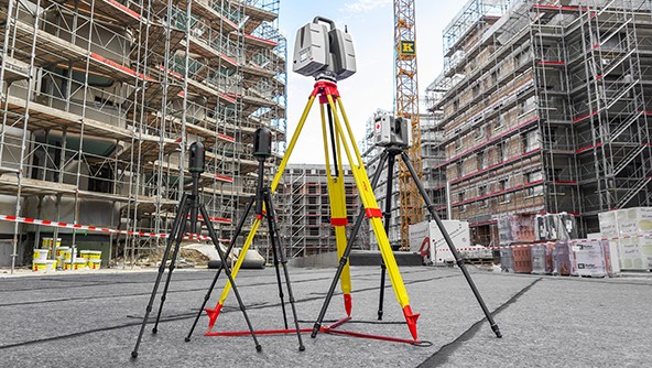
3D Laser Scanning & BIM Survey Services
3D laser scanning is an advanced surveying technique used to capture highly accurate spatial data of structures and environments. It generates detailed point cloud data that can be used to create precise 3D models.
Our team provides laser scanning services for buildings, infrastructure, and complex structures, supporting scan-to-BIM workflows and digital documentation. This technology allows fast data collection with high accuracy, reducing time and manual errors.
These services are widely used for renovation projects, structural analysis, clash detection, and accurate as-built modeling.
Key Benefits
High-precision 3D data capture
Fast and efficient data collection
Supports BIM modeling and integration
Ideal for complex and large-scale projects
Our 3D Laser Scanning & BIM Services
3D Laser Scanning
High-density point cloud capture of buildings, sites, and structures using terrestrial laser scanning equipment, delivering millimetre-level accuracy across complex or hard-to-measure spaces.
Scan-to-BIM Modeling
Conversion of raw point cloud data into structured BIM models (Revit-compatible), giving design and engineering teams an accurate digital twin of existing conditions to build from.
As-Built 3D Documentation
Detailed, scan-based as-built records for structures where traditional measurement methods aren't detailed or accurate enough, ideal for complex MEP, industrial, or heritage projects.
Clash Detection Support
Point cloud data used to identify potential clashes between new design elements and existing structural or MEP conditions, before construction begins.
Renovation & Retrofit Scanning
Accurate capture of existing buildings ahead of renovation or retrofit work, reducing design guesswork and minimizing costly surprises during construction.
Facility & Industrial Site Scanning
High-detail scanning for industrial facilities, plants, and complex mechanical spaces, supporting maintenance planning, upgrades, and facility management.
Why UAE Contractors & Consultants Trust Core Axis for 3D Laser Scanning
Accuracy That Traditional Methods Can't Match
Millions of data points captured per scan means far less room for the gaps and assumptions that come with conventional measurement.
Scan-to-BIM Expertise
We don't just hand over raw point clouds, our team converts data into structured, BIM-compatible models your design team can actually use.
Minimal Site Disruption
Fast, non-intrusive scanning that captures a comprehensive dataset in far less time than repeated manual measurement would take.
Deliverables Built for Your Workflow
Point clouds, BIM models, and CAD drawings formatted for direct use by architects, engineers, and facility teams, no extra conversion work on your end.

