What is Land Surveying in UAE : Complete Guide
Overview of What is Land Surveying in UAE, this blog includes what is land surveying, Where land surveying used for?, and how to choose the right land surveying company



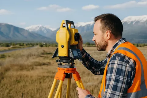
What Is Land Surveying?
Land surveying is the process of measuring and mapping the Earth's surface to determine the precise location, boundaries, dimensions, and elevation of land. By using advanced surveying techniques and equipment, surveyors collect accurate data to create maps, site plans, and legal property boundaries, supporting construction, engineering, infrastructure development, and land management projects.
Where Is Land Surveying Used For?
Every successful project relies on accurate land surveying from initial planning through final completion.
1. Site Analysis
Land surveying evaluates the suitability of a site for development by analyzing topography, elevations, drainage patterns, existing features, and overall site conditions. This information helps engineers and developers make informed planning decisions.
2. Boundary Verification & Legal Protection
Accurate land surveys establish and verify property boundaries, helping prevent encroachments and boundary disputes. Clearly defined property lines ensure compliance with legal requirements and protect landowners from costly conflicts.
3. Safety & Risk Mitigation
Surveying identifies potential site hazards such as flood-prone areas, unstable ground conditions, underground utilities, and other environmental risks before construction begins. This helps improve safety, reduce project delays, and minimize unexpected costs.
4. As‑Built Verification
Once construction is complete, an as-built survey verifies that the finished structure conforms to the approved design, engineering specifications, and regulatory standards. It provides an accurate record of the completed project for future maintenance and compliance.
Why Land Surveying Is Essential for Every Construction Project in the UAE
Every successful construction and infrastructure project in the UAE begins with accurate land surveying. It provides precise property boundaries, verifies site dimensions, and captures essential topographical data that architects, engineers, and developers rely on throughout the project lifecycle. Without reliable survey information, projects may face design inaccuracies, construction delays, boundary disputes, increased costs, and compliance challenges. Accurate land surveying lays the foundation for safe, efficient, and legally compliant project execution.
A trusted land surveying company in the UAE provides solutions for your land survey. Core Axis Survey is the best surveyor in the UAE for your surveying services.
How to Choose the Right Land Surveying Company in the UAE
Choosing a trusted land surveying company in the UAE is essential for accurate and reliable surveying solutions. From boundary verification to topographic mapping, professional surveying lays the groundwork for accurate planning. Core Axis Survey Engineering provides professional land surveying services using advanced technology and experienced surveyors to support construction, infrastructure, and development projects across the UAE. Contact Us to discuss your project requirements and get reliable survey support from day one.

