How Long Does a Bathymetry Survey Take?
How long does a bathymetry survey really take? See the real timeline stages, what affects duration, and how to keep your UAE project on schedule.


It's usually one of the first questions everyone’s asks when a bathymetry survey comes up: “Okay, but how long is this actually going to take?” It's a fair question, and also one without a single neat answer because a bathymetry survey isn't really one task, it's a sequence of stages, and each one can stretch or compress depending on the project.
Some bathymetric surveys wrap up field data collection in a single day. Others, particularly larger port, dredging, or offshore projects, run across several weeks once you account for planning, mobilization, data collection, processing, and reporting. Neither answer is wrong they're just describing very different projects.
As a survey team that works on marine and coastal projects across the UAE, this is a conversation we have with clients constantly, so let's break down exactly what determines a bathymetry survey's timeline, stage by stage.
What Is a Bathymetry Survey?
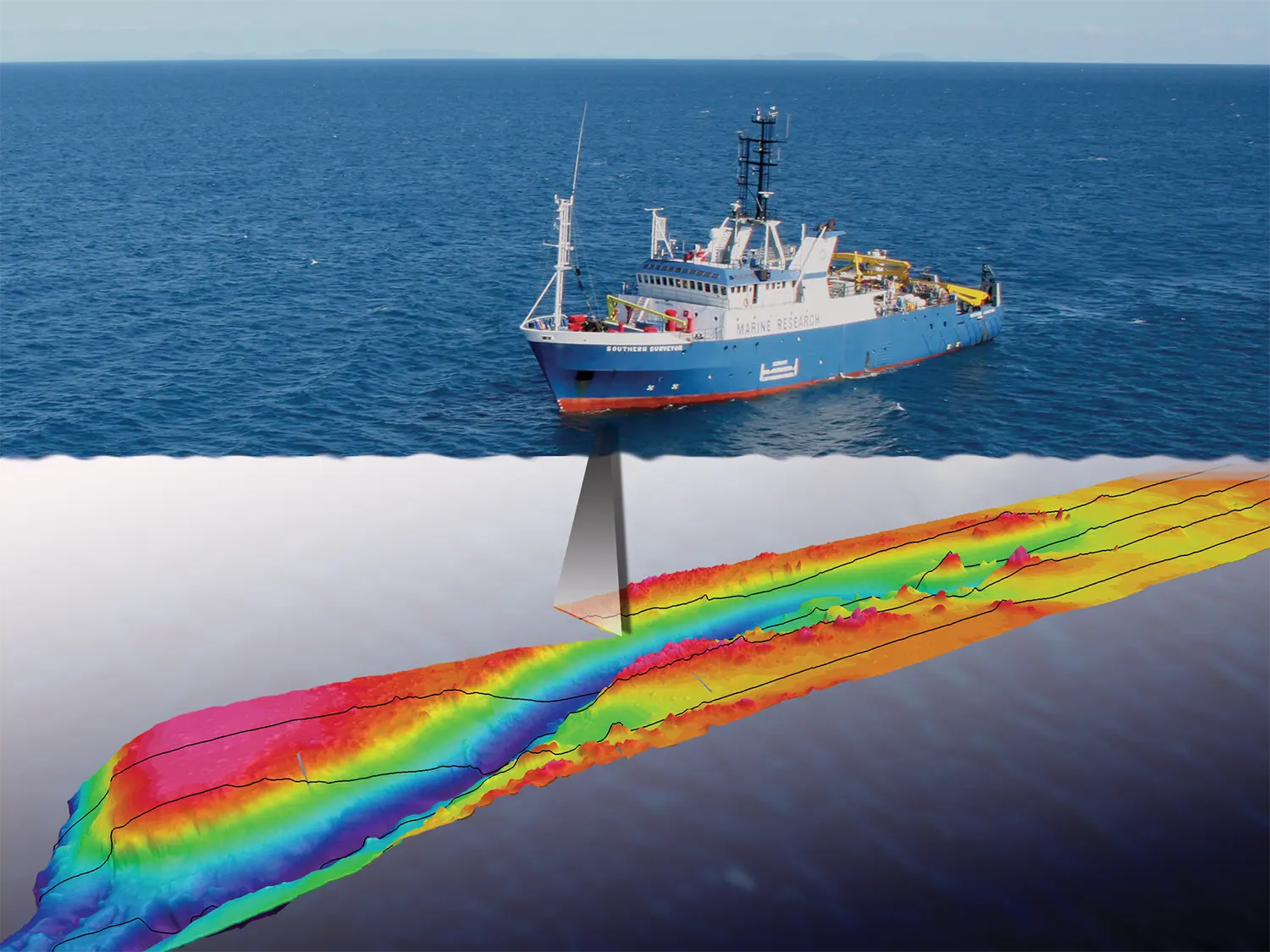
A bathymetry survey measures and maps underwater depths and seabed contours, typically using echo sounding equipment mounted on a survey vessel. It's the underwater equivalent of a topographical survey producing a detailed model of what's beneath the water surface, used to support dredging, marine construction, port development, and coastal engineering projects.
The Process of Bathymetry Survey
The mistake a lot of people make when estimating survey duration is thinking about only one part of the process the day the boat is actually out on the water. In reality, that's often the shortest stage. A full bathymetry survey typically moves through five distinct phases, and each one has its own timeline.
1. Planning & Preparation ( Typically 1 to 3 Days )
Before anyone gets near the water, the project scope needs to be properly defined: survey boundaries, required accuracy, the coordinate and vertical reference systems to use, and any marine permits or access approvals. Rushing this stage is how surveys end up with rework later it's worth getting right.
2. Mobilization & Equipment Setup ( Typically 1 to 2 Days )
The survey vessel is prepared, echo sounders and GNSS positioning equipment are installed and calibrated, and everything is tested before heading out. Skipping proper calibration to save a day here is a false economy it usually costs more time later in data processing.
3. Field Data Collection ( One Day to Several Weeks )
This is the stage most people picture when they think “survey” the vessel running survey lines, echo sounders recording depth data as it goes. Duration here depends heavily on the size of the area, water depth, required data density, and weather conditions. A small marina might be done in a day. A port or offshore pipeline route can take weeks.
4. Data Processing & Quality Control ( Typically 2 to 5 Days )
Raw depth data isn't usable on its own. It needs positioning corrections, tide and water-level adjustments, sound velocity corrections, and a pass to filter out anomalous readings, before it's turned into a reliable bathymetric surface. This stage is easy to underestimatefor complex or high-density datasets, it can take as long as the fieldwork itself.
5. Reporting & Final Deliverables ( Typically 2 to 5 Days )
Once the data has been processed and validated, it's compiled into the format your project actually needs, contour maps, digital terrain models, CAD drawings, GIS files, or a full technical report. More complex deliverables take longer to prepare and check.
What Actually Drives the Timeline Longer or Shorter
Survey Area & Project Size
The bigger the area, the more survey lines and vessel time it takes to cover it but size alone doesn't tell the whole story. A small marina needing dense, high-resolution data can take longer than a much larger reservoir surveyed to a lighter accuracy standard.
Water Depth & Site Conditions
Shallow water often means slower vessel speeds or smaller survey craft. Congested sites busy ports, narrow channels, submerged structures can also force survey teams to work in stages rather than a single continuous pass.
Purpose of the Survey
A pre-dredge survey needing precise volume calculations is a different job to a general reconnaissance survey. The more the deliverable depends on precision, the longer planning, data collection, and processing tend to take.
Equipment Used
Multibeam echo sounders capture far more data per pass than single-beam systems, which can mean faster area coverage but also more data to process afterward. It's a trade-off, not a straightforward “faster is better” equation.
Weather & Tidal Conditions
Bathymetry survey work depends on safe, stable conditions on the water. Wind, waves, strong currents, and tidal windows can all shift a schedule something land-based surveys rarely have to plan around.
Accuracy & Data Density Requirements
Tighter accuracy tolerances usually mean closer survey line spacing, more calibration checks, and more thorough processing all of which add time, but also add confidence in the final result.
How You Can Help Keep Your Bathymetry Survey on Schedule
A good chunk of survey delay isn't caused by the water it's caused by incomplete information at the planning stage. Sharing the following upfront makes a real difference to how quickly and smoothly a survey moves:
• Clear project objectives and intended use of the data
• Survey boundary and required coverage area
• Required horizontal and vertical reference systems
• Required accuracy and data density
• Expected deliverables and preferred file formats
• Any existing survey data for the site
• Site access details and any marine permits or restrictions already in place

